Hidden in Plain Sight
The secrets of Minto Flats contain life lessons

When people visit Alaska, they most often remember sights like Denali and the Alaska Range, the Inside Passage, Glacier Bay, the brown bears at Katmai National Park, or the sea life in Kenai Fjords. With so many natural wonders in Alaska, there are places easily overlooked. One of those places is Minto Flats.
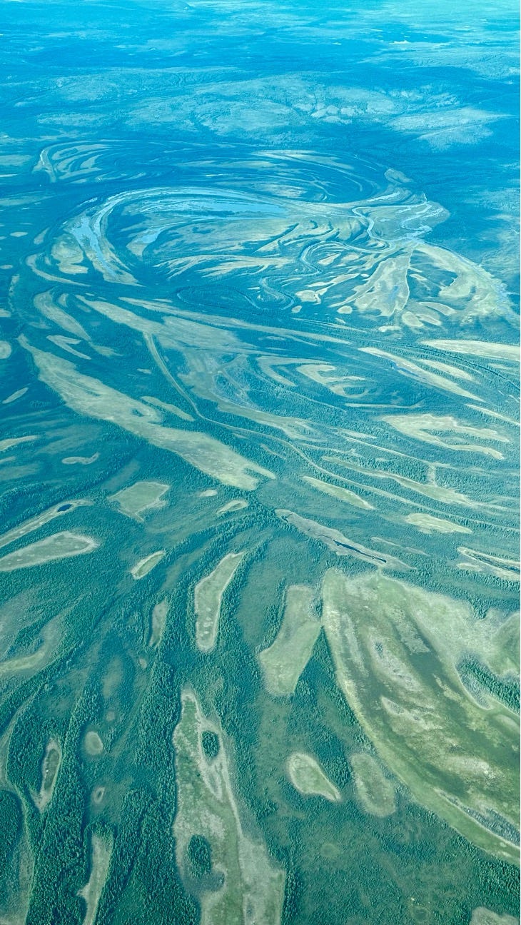
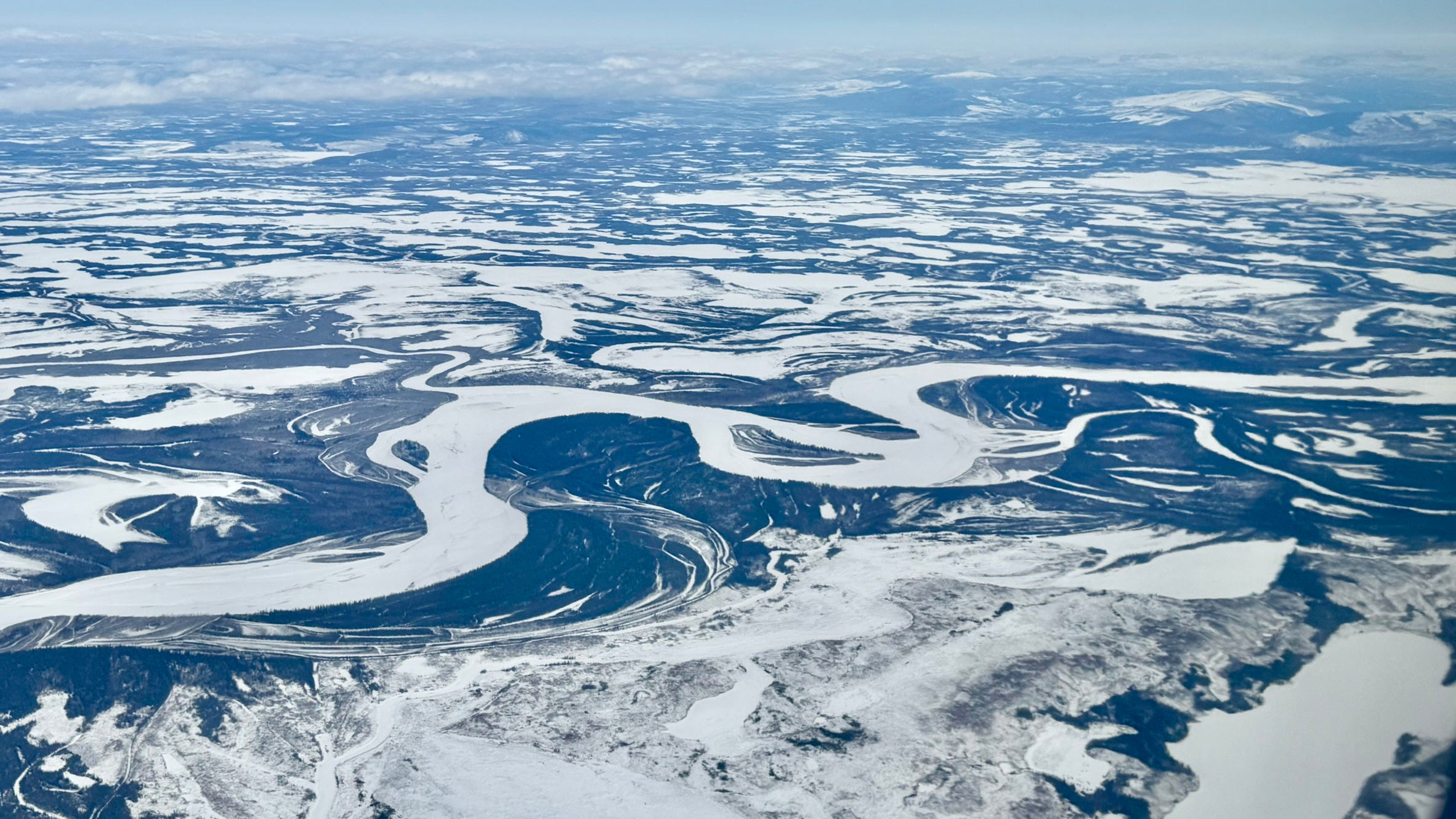
From the air, Minto Flats looks like nothing much at all.
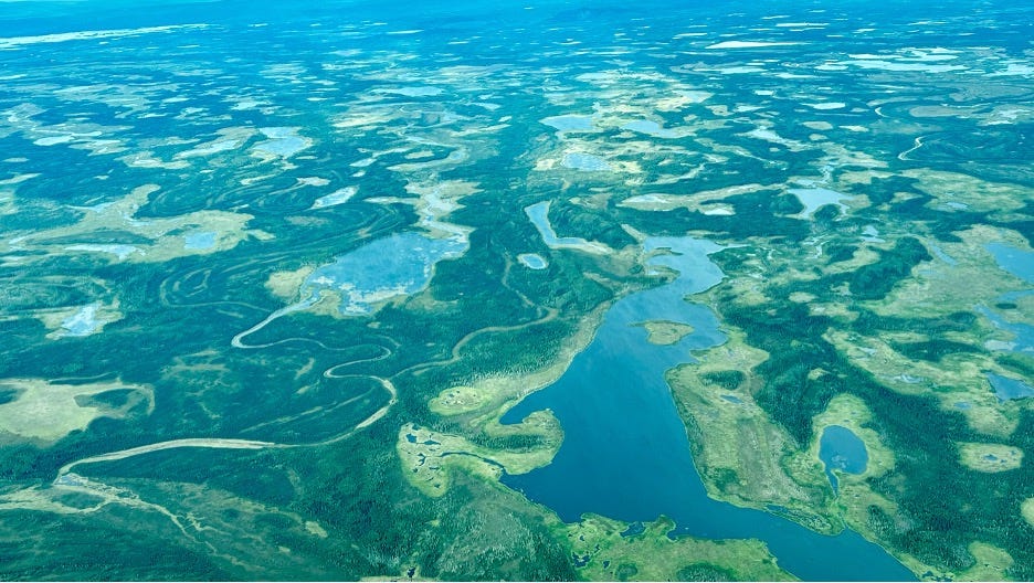
An oval expanse of swampy lowlands stretching west from Fairbanks, larger than Anchorage but somehow less immediately remarkable. Flat. Wet. A patchwork of muskeg and shallow lakes, braided streams cutting lazy channels through the green-brown surface. The kind of landscape you might fly over and forget, your attention drawn instead to the dramatic peaks of the Alaska Range in the distance or the silver thread of the Tanana River winding through the Interior.
On the ground, it’s not much different.
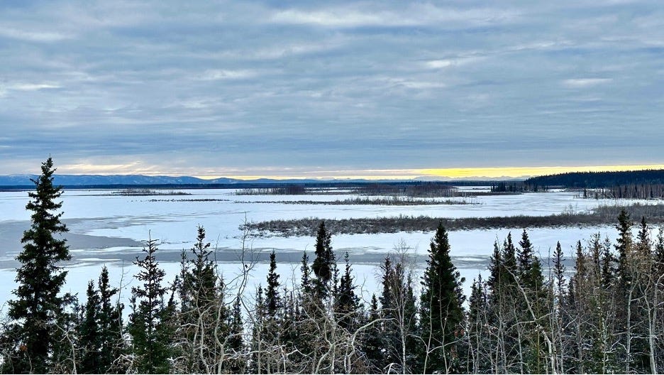
The flats are quiet, spongy underfoot, thick with mosquitoes in summer. The labyrinthine creeks, streams, rivers and lakes form a frozen highway for people and wildlife in the winter. Moose browse in the willows. Beavers work their engineering projects along the creeks. Black bears leave tracks in the mud. It’s productive country—the Minto Flats State Game Refuge was established in 1988 to protect habitat that has sustained local indigenous communities for longer than anyone’s memory—but it doesn’t announce itself. There are no grand vistas here, no postcard moments. Just miles and miles of wetland, unremarkable and easy to overlook.
Which is exactly what makes it fascinating.
Because beneath that deceptively simple surface, Minto Flats is hiding something extraordinary. The flatness itself is a kind of deception, a mask over depths that would swallow mountains. What looks like nothing is actually a great hollow in the earth, a geological secret hidden in plain sight.
In 1961, a geologist named David Barnes discovered something strange about Minto Flats: gravity doesn’t pull quite as hard there as it does in the surrounding hills. The force holding you to the ground is measurably weaker at the center of the flats than it is just a few miles away. That “gravity low,” as scientists call it, revealed what the surface conceals—a descending basin 56 miles long, carved deep into the earth’s crust. If you could somehow scoop out all the muck and sediment that fills it, the hollow would be deep enough to swallow Denali, Alaska’s great mountain and North America’s tallest, and still have room to spare.
The basin is sinking. Has been sinking for millions of years. And as it sinks, rivers—especially the massive, sediment-laden Tanana—have been filling it back up, pumping ground-up rock and soil from it’s drainage into the depression, layer upon layer of fill that now amplifies the effects of earthquakes in ways that make seismologists nervous. The soft sediment shakes harder and longer than solid bedrock would.
And then there are the faults.
Two long fault lines run beneath Minto Flats, invisible from above, hidden by the self-healing surface of muskeg and water. You can’t see them—there are no dramatic scarps or offset ridges, no obvious tears in the landscape. The spongy ground absorbs and conceals the evidence of tectonic motion. But the faults are there, lurking deep beneath the wetlands, capable of producing magnitude 7 earthquakes when the plates of surface crust slip past one another. Fairbanks, just 35 miles to the east, has felt the shaking before—magnitude 7.2 quakes in both 1937 and 1947, a magnitude 6 in 1995 that many residents remember as the most vigorous shaking they’ve ever experienced.
Ned Rozell, a science writer for the University of Alaska Fairbanks Geophysical Institute and inspiration for this story, has written about what he calls “the great hollow of Minto Flats,” describing the strange sensation of traveling across a landscape that seems so ordinary while knowing what lies beneath. Scientists like Carl Tape, Michael West, and their colleagues have been so intrigued by the hidden fault zone that they’ve installed seismometers throughout the area, floating down the Tanana River on rafts to scout locations, setting up sensitive ground-motion detectors to listen to what the earth is doing when no one can see it. They’re trying to understand the Minto Flats seismic zone, to measure the invisible forces at work, to predict what might happen when the hidden faults decide to move again.
It’s a peculiar kind of danger—one that doesn’t announce itself, that gives no visual warning. The landscape looks peaceful, productive, stable. Moose graze. Beavers build. Waterfowl nest in numbers that make Minto Flats one of the most important breeding habitats in Alaska, possibly in all of North America. Life thrives on the surface while, far below, tectonic plates grind against each other in the dark, building pressure that will eventually be released.
There’s something almost philosophical about it. The way the most dramatic forces can be completely invisible. The way what appears simple—just a flat expanse of wetland—can contain such profound complexity. The way the surface tells you almost nothing about what’s really going on.
I think about this a lot, living in Alaska. How much of what matters is hidden. How the most important things are often the hardest to see. The permafrost beneath the tundra, slowly thawing. The salmon returning to streams, following magnetic fields we can’t perceive. The aurora dancing on solar winds, funneled into the atmosphere by the Earth’s magnetic field that we can’t feel. The whole state is like this—full of invisible forces shaping visible landscapes and skyscapes, full of depths concealed by surfaces.
Minto Flats is just a special example. A place where the gap between appearance and reality is extreme. Where the flattest landscape in the region sits atop one of the deepest basins. Where the quietest, most peaceful-looking wetlands hide some of the most seismically active faults. Where gravity itself is weaker, as if the earth is trying to tell you something if you know how to listen.
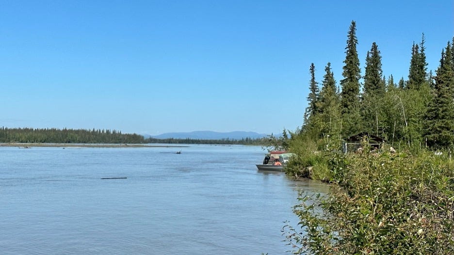
The Tanana River, carrying its millions of pounds of sediment past the flats every hour, is part of the story too. It’s both creator and concealer—filling the basin even as the basin sinks, building the surface even as the depths grow deeper. The river doesn’t care about the paradox. It just keeps flowing, keeps depositing, keeps doing the slow work of geological time while we watch and try to understand.
And maybe that’s the real lesson of Minto Flats. Not just that hidden complexity exists—we know that intellectually, but that it exists everywhere, even in the places that seem most ordinary. Especially in those places. That the world is full of depths we can’t see, forces we can’t feel, stories we’d never guess just by looking.
It’s easy to be impressed by the obvious—by Denali’s peak, by the drama of calving glaciers, by the spectacle of the northern lights. Those things demand attention. They announce themselves. But Minto Flats asks something different of you. It asks you to look at what seems unremarkable and wonder what you’re missing. To consider that the flat, wet, mosquito-ridden lowlands might be more interesting than the mountains.
I keep my photos of Minto Flats—the aerial shots showing the vast expanse of wetlands, the ground-level images of muskeg and streams—as a reminder. Not of what I saw, but of what I couldn’t see. Of the great hollow beneath the surface. Of the hidden faults waiting to slip. Of the gravity low that reveals depths invisible to the eye.
Because if Minto Flats can hide a basin deep enough to swallow mountains, what else are we missing? The most interesting stories, it turns out, are often the ones that don’t advertise themselves. The ones you have to work to find. That’s where the secrets are hiding.
Ned Rozell recently retired from writing the Alaska Science Forum column for the local newspaper, the Fairbanks Daily News-Miner. He opened my eyes to the wonders of Interior Alaska since I moved here in 2023. I never met him, but I will miss his writing.